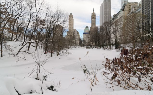
Photo: Central Park, NY,after 2016 blizzard Credit: King of Hearts/Wikimedia Commons
Blizzard conditions with snow showers, gusty winds and biting chill are all on their way to hit the Eastern Coast this weekend as the region experiences coldest weather in years.
The storm has been dubbed as “bomb cyclone” as it moves to envelope huge swathes of the East coast.
Ahead of the snowstorm, Washington metro area will receive an inch of snow Thursday morning, creating slippery conditions on roads during morning rush hours.
Virginia has declared a state of emergency to bring to use all resources to tackle any situation.
“With this forecast in mind, all Virginians should take the necessary precautions now to ensure they are prepared for the travel disruptions, power outages and other threats to health and safety that could arise during this significant weather event,” Governor McAuliffe, said.
Most parts of Maryland and D.C. are expected to receive not more than a couple of inches of snow on Thursday but eastern parts in the region are expected to have several inches of snow.
But it is the arrival of the snowstorm later this week, which is expected to the hit the regions with a strong blizzard force.
Winter weather will impact the entire East Coast today through Friday. Here are the latest expected snow totals and current winter headlines. Strong winds will accompany the snow in many locations. Stay informed at https://t.co/VyWINDk3xP or your trusted weather source!
pic.twitter.com/RqCr3h6XR1
— National Weather Service (@NWS) January 3, 2018
According to the National Weather Service, a stubborn arctic air mass will persist across much of the U.S. east of the Rockies through this week.
The afternoon high temperatures are expected to be as much as 20 to 25 degrees below normal by weekend from the Midwest to the entire Eastern Seaboard, forecasters say.
“This will help set the stage for a major winter storm to impact portions of the East Coast tonight and into Thursday and Friday.”
Much of the United States from Texas to New England has seen freezing cold during the past few weeks.
This rapidly intensifying East Coast storm will produce strong, damaging winds – possibly resulting in downed trees, power outages and coastal flooding. These strong winter systems are notorious for packing big winds and waves to go along with heavy snow! https://t.co/VyWINDk3xP pic.twitter.com/WqpNXoNDmp
— National Weather Service (@NWS) January 3, 2018
An area of low pressure was situated off the Florida coast Wednesday with all indications to rapidly deepen as it moves northward through the western Atlantic on Thursday, according to the forecast.
The NWS has reported freezing rain and snow along the Southeast Coast which will spread northward along the Eastern Seaboard tonight and tomorrow.
The current forecast calls for anywhere from 6 to 12 inches of snow accumulation along the East coast from Virginia Beach to Boston while higher amounts of 12 to 18+ inches is possible for portions of northern New England.
Adding to the chill will be a tight pressure causing gusty winds across much of the Eastern U.S. leading to “dangerously cold wind chills and Blizzard conditions in some places.”


